






The El Niño Everyone Is Hocking About
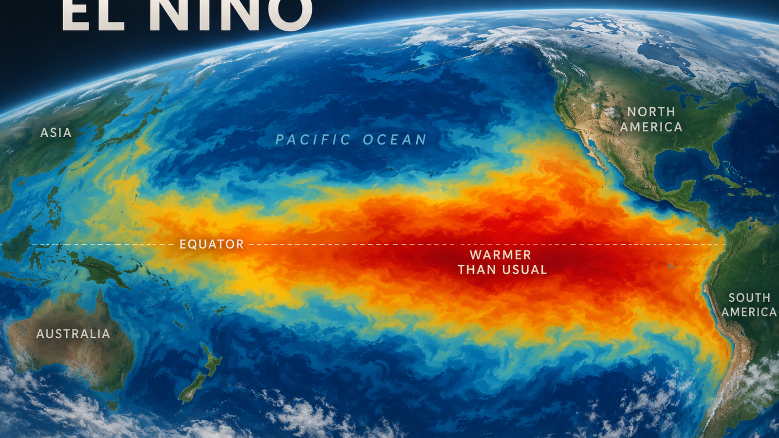


If you’ve been seeing winter forecasts lately, you’ve probably seen El Niño mentioned approximately 400 times.
And this year there’s a reason. The El Niño currently developing in the Pacific is unusually strong. The World Meteorological Organization says it could become one of the strongest, possibly the strongest, on record, and it’s expected to stick around through the winter.
Which has naturally led to headlines about a warmer winter in Canada.
But what does water in the Pacific Ocean have to do with whether you need three layers to walk down Bathurst in January?
Here’s the simple version.
First, What Even Is El Niño?
El Niño is not a storm.
It’s not a warm front headed toward Toronto.
And it’s definitely not a guarantee that we’re getting an easy winter.
El Niño is a natural weather pattern that begins in the tropical Pacific Ocean, thousands of kilometres away from us.
Normally, winds blowing across the Pacific push warm surface water westward. Colder water from deeper in the ocean then rises toward the surface closer to South America.
During an El Niño, those winds weaken or change direction. That allows the warm water to spread eastward, while less of that colder deep water reaches the surface.
The result is a huge area of the central and eastern Pacific becoming warmer than it normally is.
And because the Pacific is enormous, we're not talking about the equivalent of someone turning up the temperature in a bathtub or swimming pool.
We're talking about enough warm ocean water to change what happens in the atmosphere above it.
Okay, But How Does That Reach Toronto?
This is where the jet stream comes in.
The jet stream is basically a very fast-moving current of air high above us. It travels across North America and helps steer weather systems around the continent.
Where that current goes can help determine whether cold Arctic air drops south into Ontario, whether milder air moves north, and where storms tend to travel.
When El Niño warms the Pacific, it changes the way heat and moisture move from the ocean into the atmosphere. And suddenly, something happening in the Pacific can influence the weather thousands of kilometres away in Canada.
So El Niño = Warm Toronto Winter?
Not quite.
Historically, El Niño tends to bring milder winter conditions to parts of Canada, particularly western and central Canada. Environment and Climate Change Canada says the effects are generally less pronounced as you move farther east.
Toronto is therefore not in the part of Canada where the El Niño connection is strongest.
But a strong El Niño can still tilt the larger North American weather pattern toward milder conditions, and this year's event is particularly powerful. Current forecasts are pointing toward warmer winter conditions across Canada and the northern United States.
The key word is tilt.
El Niño makes certain kinds of weather more likely. It doesn't decide what the temperature will be on January 14.
Then What Does “Warmer Than Normal” Actually Mean?
This is probably the most important part.
When meteorologists say Toronto could have a warmer-than-normal winter, they aren't saying every day will be warm. They're talking about the average over a long period of time.
Toronto could have a relatively mild December, a freezing week in January, a giant snowstorm in February and another stretch of mild weather after that.
Add everything together, and the winter could still finish warmer than Toronto's historical average.
So yes, you can have a warmer-than-normal winter and still have brutally cold days.
Both can be true.
Does El Niño Mean Less Snow?
Not necessarily.
Temperature and snowfall aren't the same forecast.
A milder winter can mean some storms that might normally have produced snow instead bring rain, freezing rain or a sloppy mixture of everything.
But El Niño also changes storm tracks and moisture patterns.
If a moisture-packed storm arrives at exactly the same time as a pocket of cold air over southern Ontario, we can still get walloped with snow.
That's why “milder winter” should never be translated into “snow-free winter.” It just doesn't work that way.
And Why Is Everyone Talking About This El Niño?
Because this isn't looking like an ordinary one.
El Niño comes around roughly every two to seven years, but its strength varies considerably.
The current event has strengthened very quickly. The WMO said last week that it is already among the strongest El Niño events observed since 1950 and could strengthen further.
That's why you're seeing so much winter speculation already.
A stronger El Niño can make its usual influence on global weather patterns more noticeable, although even a very strong El Niño doesn't guarantee that every region will behave exactly as it did during previous strong events.
So What Should We Actually Expect in Toronto?
For now, the useful takeaway is that there is a legitimate reason to think Toronto’s winter could lean milder than normal.
What we cannot say in September is whether Toronto will have a snowy winter, how many major storms we’ll get, or whether January will feel particularly cold.
That’s the difference between a seasonal outlook and a weather forecast. El Niño can give meteorologists clues about the overall direction of the winter months ahead. It can’t tell us what will be falling from the sky on a random Tuesday in February.
So when you see another headline saying “El Niño could bring Toronto a warmer winter,” you don’t need to ignore it.
Just translate it properly as: The odds are leaning milder. This is still Toronto
🙂